Freight ship travel speed is a key factor in global trade, and at TRAVELS.EDU.VN, we understand its significance. On average, a freight ship travels at about 12-25 knots (14-29 mph or 22-46 km/h), but this can vary based on ship type, size, and weather conditions. We provide seamless travel planning, and we prioritize providing current, reliable insights that improve your travel logistics..
Now, let’s get more specific with a detailed look at how fast freight ships actually travel and all of the factors that influence their speed.
1. What Is The Average Speed Of A Freight Ship?
The average speed of a freight ship ranges from 12 to 25 knots. Several factors, including the type of vessel, its size, the weather, and economic considerations, can affect this speed. For example, container ships, which need to maintain schedules, typically travel faster than bulk carriers.
Let’s delve into the elements that impact the velocity of these maritime giants.
1.1 Factors Influencing Freight Ship Speed
Several key factors impact how fast a freight ship travels:
- Type of Ship: Container ships are designed for speed to maintain tight schedules, whereas bulk carriers and oil tankers often travel slower.
- Size and Load: Larger ships and heavier loads reduce speed. A fully loaded ship sits lower in the water, creating more drag.
- Weather Conditions: Storms, high winds, and rough seas can significantly slow down a ship’s progress.
- Economic Factors: Fuel costs and market demand can influence a ship’s speed. Lower fuel prices might encourage faster travel, while oversupply might lead to slower steaming to conserve fuel.
1.2 The Knot: Measuring Speed at Sea
In maritime terms, speed is measured in knots. One knot is equal to one nautical mile per hour, with a nautical mile being approximately 1.15 statute miles (1.85 kilometers). This unit is used because it directly relates to the Earth’s coordinates, making navigation easier.
Understanding knots helps in estimating travel times and planning logistics. For instance, a ship traveling at 20 knots covers 20 nautical miles in an hour.
2. What Are Typical Speeds for Different Types of Freight Ships?
Different types of freight ships have varying speed profiles based on their design and purpose.
- Container Ships: These ships usually travel at speeds between 20 to 25 knots (23 – 29 mph or 37 – 46 km/h).
- Bulk Carriers: Typically slower, traveling at around 11 to 15 knots (13-17 mph or 20-28 km/h).
- Oil Tankers: Similar to bulk carriers, with speeds of 12 to 16 knots (14-18 mph or 22-30 km/h).
These differences are due to the operational demands and physical characteristics of each type of ship. Container ships need to adhere to strict schedules, while bulk carriers and tankers prioritize fuel efficiency over speed.
3. How Do Weather Conditions Affect Freight Ship Speed?
Weather conditions significantly affect the speed and safety of freight ships. TRAVELS.EDU.VN always considers weather forecasts when planning routes to minimize delays and ensure safety.
- Storms and High Winds: Can reduce speed by 20-50% due to safety concerns and the need to navigate around severe weather.
- Rough Seas: Increase drag and can cause the ship to pitch and roll, slowing it down.
- Favorable Weather: Can allow ships to maintain or even slightly increase their speed.
Captains and navigators carefully monitor weather patterns and adjust routes to avoid the worst conditions. Modern weather routing services provide optimal paths that minimize weather-related delays.
4. What Is “Slow Steaming” and How Does It Impact Travel Time?
Slow steaming is a strategy where ships travel at a reduced speed to save fuel and reduce emissions. This practice has become more common in recent years due to rising fuel costs and environmental regulations.
4.1 Benefits of Slow Steaming
- Fuel Efficiency: Reduces fuel consumption by 10-25% or more, significantly cutting operational costs.
- Reduced Emissions: Lowers greenhouse gas emissions, helping shipping companies meet environmental standards.
- Cost Savings: Lower fuel costs translate to higher profits, especially when fuel prices are high.
4.2 Drawbacks of Slow Steaming
- Longer Transit Times: Increases the time it takes for goods to reach their destination.
- Schedule Disruptions: Can lead to delays and impact supply chain efficiency.
- Increased Operational Costs: May require additional ships to maintain the same level of service.
Despite the drawbacks, slow steaming remains a popular strategy due to its economic and environmental benefits.
5. What Routes Do Freight Ships Typically Take?
Freight ships follow well-established routes that connect major ports around the world. These routes are determined by factors such as distance, safety, and the availability of canals and straits.
5.1 Major Shipping Routes
- Transpacific Route: Connects Asia and North America, handling a large volume of container traffic.
- Suez Canal Route: Connects Europe and Asia, providing a shortcut through the Middle East.
- Panama Canal Route: Connects the Atlantic and Pacific Oceans, avoiding the need to sail around South America.
- Cape of Good Hope Route: Used for voyages between Asia and South America or Africa, particularly for ships too large to transit the Suez or Panama Canals.
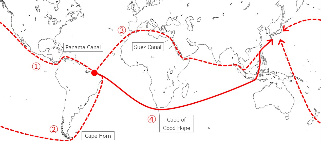 4 possible route from Brasil to Japan
5.2 Factors Determining Shipping Routes
- Distance: The shortest distance between ports is usually preferred, but not always feasible due to other constraints.
- Canal and Strait Availability: The Suez and Panama Canals offer significant time savings, but have size and cost limitations.
- Safety: Routes must avoid hazardous areas such as piracy zones, conflict zones, and regions with severe weather.
- Economic Considerations: Tolls, fuel costs, and other expenses influence route selection.
6. How Far Can A Freight Ship Travel In A Day?
The distance a freight ship can travel in a day depends on its speed. Assuming an average speed of 15 knots (17.3 mph or 27.8 km/h), a ship can cover approximately 360 nautical miles (414 statute miles or 667 kilometers) in a day.
6.1 Factors Affecting Daily Travel Distance
- Speed: Higher speed directly translates to greater distance covered.
- Weather: Adverse weather reduces speed and, consequently, daily travel distance.
- Route Efficiency: Direct routes allow for more distance covered compared to indirect routes with frequent turns or detours.
Planning for these factors is crucial for accurate delivery estimates.
7. What Technologies Are Used to Track Freight Ship Speed and Location?
Modern technology plays a vital role in tracking freight ships, ensuring safety, and optimizing routes.
7.1 Key Technologies
- Global Positioning System (GPS): Provides precise location data, enabling accurate tracking and navigation.
- Automatic Identification System (AIS): Transmits ship identification, location, speed, and other data to nearby ships and shore-based stations.
- Electronic Chart Display and Information System (ECDIS): Integrates GPS, radar, and other sensors to provide real-time navigation information.
- Satellite Communication: Enables communication between ships and shore-based facilities, allowing for remote monitoring and data transmission.
7.2 Benefits of Tracking Technologies
- Real-Time Monitoring: Allows for continuous tracking of ship location and speed.
- Improved Safety: Enhances situational awareness and reduces the risk of collisions and groundings.
- Optimized Routes: Enables the selection of the most efficient routes based on weather, traffic, and other factors.
- Enhanced Security: Helps prevent piracy and other security threats.
8. How Do International Regulations Impact Freight Ship Speed?
International regulations play a significant role in governing freight ship operations, including speed.
8.1 Key Regulations
- International Maritime Organization (IMO): Sets standards for safety, security, and environmental performance.
- MARPOL Convention: Addresses marine pollution, including regulations on emissions from ships.
- SOLAS Convention: Focuses on safety of life at sea, including standards for navigation and communication.
8.2 Impact on Speed
- Emission Control Areas (ECAs): Require ships to use low-sulfur fuel or install scrubbers, which can affect engine performance and speed.
- Speed Limits: Some ports and waterways impose speed limits to reduce noise pollution and protect marine life.
- Safety Regulations: Mandate the use of specific navigation equipment and procedures, which can influence speed decisions.
9. How Do Shipping Companies Optimize Freight Ship Speed?
Shipping companies employ various strategies to optimize freight ship speed, balancing cost, efficiency, and environmental considerations.
9.1 Optimization Strategies
- Weather Routing: Using weather forecasts to select routes that minimize delays and fuel consumption.
- Hull Maintenance: Keeping the hull clean to reduce drag and improve fuel efficiency.
- Engine Optimization: Maintaining engines to ensure optimal performance and fuel consumption.
- Trim Optimization: Adjusting the distribution of cargo to minimize drag and improve stability.
9.2 Technology and Data Analytics
- Data Collection: Gathering data on speed, fuel consumption, weather, and other factors.
- Data Analysis: Using data analytics to identify patterns and opportunities for optimization.
- Predictive Modeling: Developing models to predict the impact of different speed and route options.
10. What Are the Future Trends in Freight Ship Speed?
The future of freight ship speed is likely to be shaped by technological advancements, environmental concerns, and economic pressures.
10.1 Potential Trends
- Increased Use of Alternative Fuels: Such as LNG, biofuels, and hydrogen, which may affect engine performance and speed capabilities.
- Autonomous Shipping: Self-driving ships could optimize speed and routes more efficiently.
- Stricter Environmental Regulations: Could lead to more widespread use of slow steaming and other fuel-saving measures.
- Advanced Hull Designs: New designs could reduce drag and improve fuel efficiency, allowing for higher speeds with less fuel consumption.
The ongoing evolution of freight ship technology and practices will continue to shape the speed and efficiency of global shipping.
 VLCC tanker
11. Understanding Nautical Miles And Knots
The maritime world relies on nautical miles and knots for measuring distance and speed, respectively. These units are essential for accurate navigation and voyage planning.
11.1 Nautical Mile Explained
A nautical mile is defined as one minute of latitude, equivalent to 1/60 of a degree of latitude. One nautical mile equals approximately 1.15 statute miles (1.85 kilometers).
11.2 Knot Explained
A knot is a unit of speed equal to one nautical mile per hour. It is used to measure the speed of a ship through water.
11.3 Why Use Nautical Miles and Knots?
- Navigation: Nautical miles and knots align with the Earth’s coordinate system, simplifying navigation.
- Consistency: They provide a standard unit of measurement in maritime contexts globally.
- Accuracy: They offer precision for calculating distances and estimating travel times at sea.
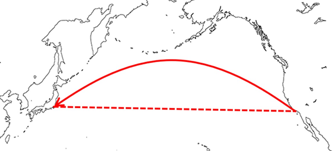
12. Great Circle vs. Rhumb Line: Navigational Strategies
When planning a voyage, navigators must decide between the Great Circle and Rhumb Line routes. Each strategy has its advantages and disadvantages.
12.1 Great Circle Route
The Great Circle route represents the shortest distance between two points on the Earth’s surface. It involves continuously adjusting the ship’s heading, making it more complex to navigate.
12.2 Rhumb Line Route
The Rhumb Line route involves maintaining a constant compass heading. It is simpler to navigate but covers a longer distance compared to the Great Circle route.
12.3 Modern Navigation
Today, modern technology like GPS enables ships to easily follow the Great Circle route, maximizing efficiency and minimizing travel time.
 Great circle
13. Case Study: Crude Oil Transport from the Middle East to Japan
Transporting crude oil from the Middle East to Japan is a complex operation involving significant distances and strategic routes.
13.1 Route Details
The typical route starts at Ras Tanura in Saudi Arabia, passes through the Strait of Hormuz, enters the Indian Ocean, navigates the straits of Malacca and Singapore, and sails through the Pacific Ocean to Tokyo Bay.
13.2 Distance and Speed
The navigation distance is approximately 6,600 miles. A crude oil tanker traveling at 14 knots would take about 470 hours (19.5 days) to complete the voyage.
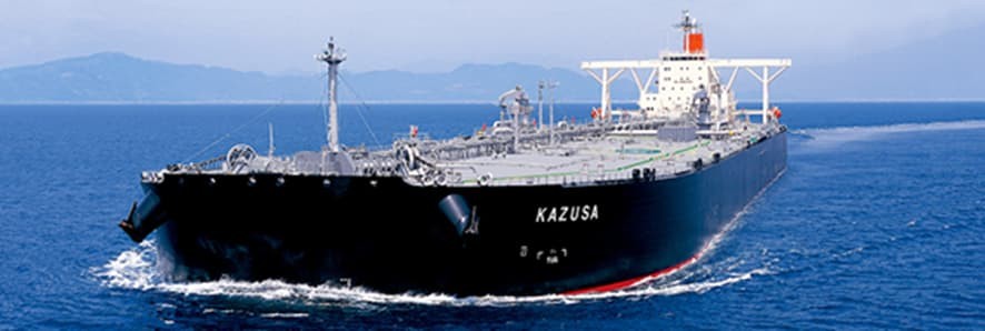
13.3 VLCCs
Very Large Crude Carriers (VLCCs) are commonly used for this route. These ships can carry around 300,000 tons of crude oil, equivalent to about 12 hours of Japan’s oil demand.
14. Case Study: Iron Ore Transport from Brazil to Japan
Transporting iron ore from Brazil to Japan involves traversing vast distances and navigating various maritime challenges.
14.1 Possible Routes
- Westbound via Panama Canal: The shortest route but limited by ship size and high costs.
- Westbound via Cape Horn: Known for hazardous weather conditions and rough seas.
- Eastbound via Suez Canal: Not economical due to ship size restrictions and canal tolls.
- Eastbound via Cape of Good Hope: The most commonly chosen route.
14.2 Route via Cape of Good Hope
This route covers approximately 12,000 miles each way, taking almost 40 days at 13 knots. Round trips, including loading and unloading, take about 3 months.
14.3 Vale Max Carriers
Super-large iron ore carriers like Vale Max, capable of carrying 400,000 tons of iron ore, enhance transport efficiency.
15. Comparing Airplanes and Ships for Cargo Transport
While ships are the backbone of global trade, airplanes offer a faster alternative for certain types of cargo.
15.1 Speed Comparison
Airplanes can transport cargo much faster than ships. A Boeing 747-8 Freighter cruises at approximately 560 knots, completing a Saudi Arabia to Tokyo trip in about 8 hours compared to 20 days for a VLCC.
15.2 Load Capacity
Ships have a significantly higher load capacity. A VLCC can carry about 2,000 times more cargo than a Boeing 747-8 Freighter.
15.3 Best Use Cases
- Airplanes: Ideal for time-sensitive deliveries.
- Ships: Best for mass and low-cost transportation.
15.4 MOL Logistics Network
TRAVELS.EDU.VN leverages an extensive logistics network with 239 locations in 123 cities across 26 countries. Services include air and ocean freight forwarding, trucking, customs clearance, warehousing, and more.
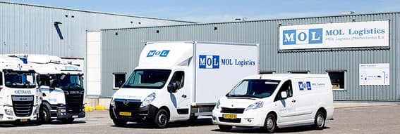 MOL logistics
16. The Role of MOL Project & Heavy Cargo
MOL Project & Heavy Cargo specializes in heavyweight and oversized cargo transport, offering comprehensive, one-stop services.
16.1 Services Offered
- Optimal transport solutions.
- Vanning.
- Coastal and land transport.
- Customs clearance.
- Assembly and installation.
16.2 Customer Benefits
MOL Project & Heavy Cargo provides seamless logistics for specialized cargo, ensuring safe and efficient delivery.
17. The Impact of Hull Design on Freight Ship Speed
The design of a ship’s hull plays a crucial role in determining its speed and fuel efficiency.
17.1 Streamlined Hull Designs
Streamlined hulls reduce water resistance, allowing ships to move faster with less energy.
17.2 Bulbous Bows
Bulbous bows create a wave that interferes with the bow wave, reducing drag and improving fuel efficiency.
17.3 Advanced Coatings
Specialized coatings minimize fouling and reduce friction, enhancing speed and fuel economy.
18. Engine Efficiency and Its Effect on Travel Speed
The efficiency of a ship’s engine directly impacts its travel speed and operational costs.
18.1 Modern Engine Technologies
Modern engines are designed to maximize fuel efficiency and reduce emissions, enabling ships to maintain higher speeds with lower fuel consumption.
18.2 Regular Maintenance
Proper engine maintenance ensures optimal performance and prolongs the lifespan of the engine, contributing to consistent travel speeds.
18.3 Fuel Quality
Using high-quality fuel enhances engine performance and reduces wear, promoting efficient and reliable operation.
19. How GPS Aids in Determining and Maintaining Freight Ship Speed
GPS (Global Positioning System) is an indispensable tool for modern maritime navigation, helping ships determine and maintain their speed accurately.
19.1 Accurate Speed Measurement
GPS provides precise location data, enabling accurate measurement of a ship’s speed over ground (SOG).
19.2 Route Optimization
GPS enables navigators to optimize routes by providing real-time information about the ship’s position, speed, and course.
19.3 Enhanced Safety
GPS enhances safety by providing accurate navigation data, reducing the risk of collisions and groundings.
20. The Influence of Maritime Insurance on Freight Ship Speed
Maritime insurance policies can influence how quickly a freight ship travels, balancing risk and operational efficiency.
20.1 Insurance Premiums
Insurance premiums may be affected by the ship’s speed and routing decisions. Faster speeds can increase the risk of accidents, potentially raising premiums.
20.2 Risk Management
Shipping companies balance the need for speed with risk management considerations, choosing routes and speeds that minimize insurance costs while ensuring timely delivery.
20.3 Compliance
Compliance with safety regulations and best practices can reduce insurance costs and improve overall operational efficiency.
Planning a trip? TRAVELS.EDU.VN simplifies travel, allowing you to focus on your journey. Ready to explore Napa Valley? Contact us for personalized tour packages that cater to your preferences. Dial +1 (707) 257-5400 or visit our office at 123 Main St, Napa, CA 94559, United States.
Frequently Asked Questions (FAQs)
21.1 What is the typical speed of a container ship?
Container ships typically travel at speeds between 20 to 25 knots (23 – 29 mph or 37 – 46 km/h).
21.2 How does weather affect the speed of a freight ship?
Storms, high winds, and rough seas can reduce a ship’s speed by 20-50%.
21.3 What is slow steaming?
Slow steaming is a strategy where ships travel at a reduced speed to save fuel and reduce emissions.
21.4 How far can a freight ship travel in a day?
At an average speed of 15 knots, a ship can cover approximately 360 nautical miles (414 statute miles or 667 kilometers) in a day.
21.5 What technologies are used to track freight ships?
GPS, AIS, ECDIS, and satellite communication are used to track freight ships.
21.6 How do international regulations impact freight ship speed?
Regulations on emissions, speed limits in certain areas, and safety standards can influence speed decisions.
21.7 How do shipping companies optimize freight ship speed?
Strategies include weather routing, hull maintenance, engine optimization, and trim optimization.
21.8 What are the future trends in freight ship speed?
Potential trends include increased use of alternative fuels, autonomous shipping, and stricter environmental regulations.
21.9 What is the difference between a nautical mile and a statute mile?
A nautical mile is approximately 1.15 statute miles.
21.10 How does GPS aid in determining and maintaining freight ship speed?
GPS provides accurate location data, enabling precise speed measurement and route optimization.
Don’t wait any longer to enjoy the perfect Napa Valley getaway! Let TRAVELS.EDU.VN take care of all the details. Contact us today and experience the best of Napa Valley with our expert planning and support. Whatsapp: +1 (707) 257-5400. Website: travels.edu.vn